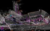
Topographical Surveys
ASES have experience in carrying out accurate cost effective, Topographic Surveys for a wide range of sectors and clients, adapting the level of detail required to suit the…
View Service

In this post we will explore the extensive benefits of accurate Topographical Surveys and key considerations to keep in mind.
Topographical surveys are a fundamental step in any construction or development project.
To understand the workings and significance of topographical surveys, it's crucial to grasp their process first.
This technical method plays a vital role in project planning, where accurate data can be the difference between success and failure.
You'll find that the process of topographical surveys, a crucial groundwork in the field of construction and planning, is quite fascinating.
The survey will start with the determination of a survey control system. A local or OS system may be adopted depending on the client specification.
Where and OS system is required, GPS technology will enable the installation of a network of control points.
These control points are then used as reference points for the survey. Data is collected using traditional theodolites or increasingly using 3D laser scanners and drones.
The use of 3D laser scanning allows rapid data capture and the creation of 3D deliverables such as REVIT models.
This data is then processed into a detailed map, showing the land's precise contours, elevations, and features.
This process is essential for any construction project to avoid potential problems and to ensure that the design accurately fits within the geometric constraints.

Why is it crucial for you to understand the importance of topographical surveys in project planning?
These surveys provide invaluable data about the land's physical features, elevations, and hidden obstacles, which are key to designing and implementing your project effectively. They allow you to visualise the land's contours and gradients, helping you to identify potential issues such as flood zones or unstable ground.
This information guides you in making informed decisions about location and design, optimising resources, and minimising potential risks. It's also essential for obtaining permits and meeting regulatory requirements.
Without a comprehensive topographical survey, you're essentially planning in the dark. So, understanding and utilising these surveys is critical to your project's success.
Understanding the process and importance of topographical surveys can significantly enhance your ability to make informed decisions in your projects. These surveys provide detailed information about the natural and man-made features of a land area. By analysing the data, you'll better understand the terrain's characteristics and potential challenges.
The information obtained from topographical surveys is essential when planning construction or engineering projects. It helps you identify potential issues such as slopes, streams, or uneven terrain that could affect the project's feasibility or cost. Additionally, the data assists in determining the best location for structures or facilities.
Therefore, understanding and utilising topographical surveys is critical for successful project planning and execution. It's a valuable tool that ensures you're making informed decisions based on precise, detailed information.
You're venturing into the realm of advanced techniques and tools in modern topographical surveys. GPS and robotic stations, UAV drone surveys, and laser scanning usage play pivotal roles in these surveys. These cutting-edge technologies have revolutionised the way we map and study the Earth's surface.
Let's scrutinise how they work and the precision they bring to topographical surveys.
By utilising advanced tools like GPS and robotic stations, you're significantly boosting the accuracy and efficiency of your topographical surveys. GPS, or Global Positioning System, pinpoints precise geographical coordinates, making your data more accurate. It's satellite-based, ensuring global coverage and continuous operation. Robotic total stations, on the other hand, automate measurements, reducing human error. They're capable of tracking, auto-targeting, and auto-pointing resulting in shorter turnaround times and presents a cost saving.
These tools also enhance productivity. GPS eliminates the need for physical markers, while robotic stations can operate without a second person, saving time and resources.
These high-tech solutions are revolutionising topographical surveys, making them more precise, efficient, and cost-effective.

In your arsenal of topographical survey tools, UAV drones are game-changers, offering unparalleled aerial perspectives and detailed data capture. You'll find them indispensable due to their ability to cover large areas quickly, provide high-resolution imagery, and access hard-to-reach locations. With advanced sensors, you can capture precise, high-density data, including infrared and thermal imaging.
You're able to control flight paths, speed, and altitude with advanced software, ensuring accurate data collection. For comprehensive surveys, you can use photogrammetry, a technique that combines multiple images to create a 3D model. UAVs can also integrate with real-time kinematic (RTK) systems for enhanced positional accuracy.
However, it's crucial to understand local regulations and safety protocols before operating a drone. Understanding drone capabilities is key in optimising their use in topographical surveys.
As you delve deeper into modern topographical survey techniques, laser scanning emerges as a critical tool, and it's revolutionising the way you approach terrain mapping. This technology uses light pulses to measure distances, creating highly precise 3D models of landscapes. It's known for its accuracy and speed, completing topographic surveys in a fraction of the time that traditional methods take.
In particular, you'll find terrestrial laser scanning invaluable. With laser scanning you can survey complex terrains with intricate details, capturing millions of points per second. The result is a comprehensive, highly detailed point cloud that's perfect for analysing terrain characteristics.
As you consider the merits of accurate topographical surveys, you'll find that they play a pivotal role in project planning. They're instrumental in preventing costly errors by providing a precise layout of the land, thereby allowing for informed and accurate design decisions.
You'll find that accurate topographical surveys can significantly help you map out your project plans more effectively. These surveys provide detailed information about the terrain and features of a site, aiding in the intelligent planning and execution of your projects.
Here are four ways accurate topographical surveys can assist in your project planning:
Relying on accurate topographical surveys is essential for project success. Misinterpretations of the land's features may lead to impractical designs, causing costly modifications or reworks later on.
In addition, these surveys can detect potential issues like drainage problems, soil instability, or unexpected slopes early on, reducing the risk of expensive surprises during construction. This early detection allows for proper mitigation measures to be put in place, ensuring a smoother execution of the project.
Furthermore, accurate topographical surveys enable you to calculate the precise quantities of materials needed. This helps in avoiding wastage and overruns in costs, contributing to financial prudence.

While you're making design decisions, accurate topographical surveys can provide indispensable data that will significantly benefit your project in numerous ways. These surveys offer a precise picture of the ground's physical features, comprehensively understanding the site.
Here are four ways how:
You will need to choose a survey coordinate system that suits the specifics of your project.
Moreover, determining the required accuracy level is crucial to ensure the validity of the survey data.
Next, you'll need to determine the required accuracy level, a key consideration that significantly impacts the quality and reliability of your topographical survey data. This step is critical, as it guides our selection of survey equipment and techniques.
Here are four key factors to consider:
It's variable, depending on the area's complexity and the ease of access and level of detail required.
A topographical survey is an essential tool when assessing any area of land. It provides detailed information about the terrain, including elevation, vegetation and other natural features like water bodies and rock formations.
This information is invaluable for determining accurate boundary positions when combined with OS map data. Topographical surveys are also used in planning for conservation and recreation areas.
In addition to providing valuable data, they can help identify potential hazards or existing infrastructure that might impact a development project.
Without a topographical survey, it would be difficult to accurately assess an area of land and make informed decisions about its use. Therefore, if you are considering any type of development or planning project related to a specific area of land, it is important that you commission a topographical survey first before proceeding.
Tech advancements, notably laser scanning and survey software improvements, have revolutionised the survey process. They've increased accuracy, efficiency, and data analysis capabilities, allowing for more comprehensive and precise topographical surveys.
The cost of a topographic land survey is directly proportional to the size and density (vegetation and infrastructure).
Complex sites may require a site visit by an experienced surveyor to accurately access methodology and the most efficient instrumentation for the task.
Laser scanned Topographical surveys reduce site time considerably and are well suited to traffic/live sites with minimum disruption to the daily operation of premises or the public.
Absolutely, topographical surveys aid in disaster prevention planning. The evolution of surveying equipment provides detailed data that you can use to devise effective mitigation strategies against potential natural disasters.
We are ready to talk about your requirements to see how we can help you.

ASES have experience in carrying out accurate cost effective, Topographic Surveys for a wide range of sectors and clients, adapting the level of detail required to suit the…
View Service
ASES implement the use of Leica and Faro technologies with integrated high definition cameras to deliver highly precise laser scanning. ASES have successfully employed the…
View Service