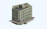
Scan to BIM
BIM projects for redevelopment or refit will usually begin their life cycle with a 3D Laser scan, our expertise enables us to correctly deliver a…
View Service
Topographic surveys serve to show physical structures, man-made and natural, including trees and vegetation, buildings, boundaries, surface changes and ground levels.
ASES have experience in carrying out accurate cost effective, Topographic Surveys for a wide range of sectors and clients, including, Architects, developers, private individuals, building contractors and designers, adapting the level of detail required to suit the client’s needs and budget. Surveys can range from back garden surveys, which enable planning applications and landscaping work to entire streetscape surveys that incorporate underground utilities.

Robotic Leica instruments and Laser Scanners allow us to accelerate the survey process and with the combination of reflector-less technology ensures measurements are possible remotely and safely.
We are flexible with the delivery of our data , drawings can be co-ordinated to local/arbitrary grid or by means of our supplied GPS, RTK rovers we can fix the survey to the Ordnance Survey national grid and level datum..

All surveys are carried out to RICS specification, Measured Surveys of Land, Buildings and Utilities. drawings can be output in 2D or 3D, delivered in the following formats.
If you're looking for a topographic survey, get in touch with ASES.
Our team of experienced surveyors can undertake measured building surveys to help you with planning and design requirements.
We are confident that we can provide the best service possible and guarantee satisfaction. Contact us now to learn more about what we can do for you!
We are ready to talk about your requirements to see how we can help you.
A topographical survey is used to map the physical features of an area of land incorporating natural and man-made features, such as buildings, boundaries, drainage and vegetation.
Topographical surveys are often presented in 2D plan or 3D model formats to accurately represent the existing site.
The collected data can then be used for various design and development intents, such as engineering and construction projects.
A topographic survey is essential in any project, especially those that involve mapping an area or determining its boundaries.
At ASES, we only implement the latest technology and have experienced surveyors to ensure comprehensive, accurate and error-free surveys.
A topographical survey is an essential tool when assessing any area of land. It provides detailed information about the terrain, including elevation, vegetation and other natural features like water bodies and rock formations.
This information is invaluable for determining accurate boundary positions when combined with OS map data. Topographical surveys are also used in planning for conservation and recreation areas.
In addition to providing valuable data, they can help identify potential hazards or existing infrastructure that might impact a development project.
Without a topographical survey, it would be difficult to accurately assess an area of land and make informed decisions about its use. Therefore, if you are considering any type of development or planning project related to a specific area of land, it is important that you commission a topographical survey first before proceeding.
Tech advancements, notably laser scanning and survey software improvements, have revolutionised the survey process. They've increased accuracy, efficiency, and data analysis capabilities, allowing for more comprehensive and precise topographical surveys.
The cost of a topographic land survey is directly proportional to the size and density (vegetation and infrastructure).
Complex sites may require a site visit by an experienced surveyor to accurately access methodology and the most efficient instrumentation for the task.
Laser scanned Topographical surveys reduce site time considerably and are well suited to traffic/live sites with minimum disruption to the daily operation of premises or the public.


BIM projects for redevelopment or refit will usually begin their life cycle with a 3D Laser scan, our expertise enables us to correctly deliver a…
View Service
